|
Aerial Photographs & Maps of the 146th Signal Co. Compound - then and now.
|
|
The 146th Signal Company, Pleiku, RVN, 1971-72
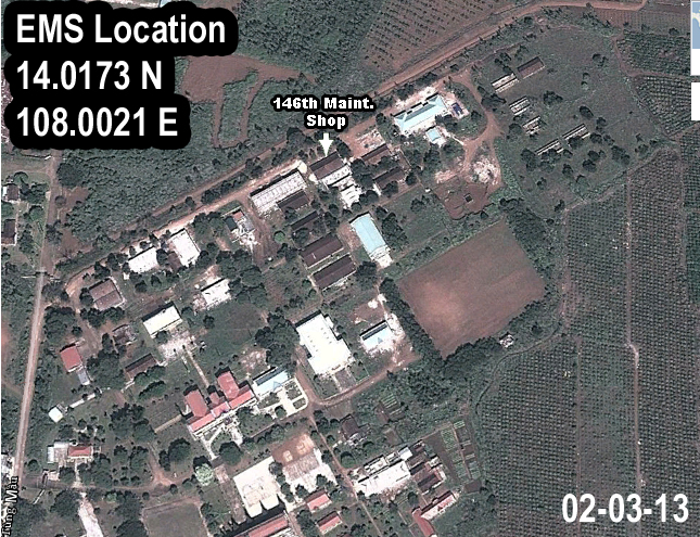
The 146th EMS Shop, located precisely at 14.017256º N, 108.002115º E is still
visible today with Google Earth, but the landscape has obviously changed.
Most of the pictures are in high resolution to bring out the best detail, so it may
take a bit longer to download this page with slow connections. Please be patient.
|
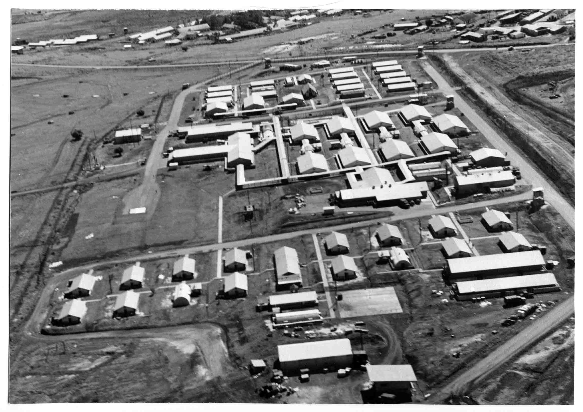
This picture was shot from the east end of the 71st Medevac compound which
included the 146th Signal Co. and a finance unit. This picture is low resolution.
Click here for the high resolution picture (2.05MB jpg)
|
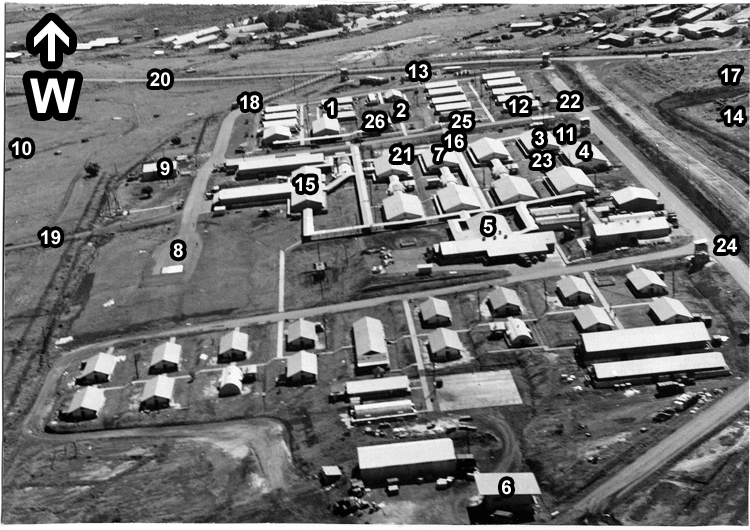
Same picture as above, annotated to
the best of my recollection of 1971.
Corrections and additions welcome.
- Officer Quarters
- Chapel
- Barracks - 146th
- 146th Signal Maint. Shop
- Mess Hall
- Motor Pool
- Barracks - Finance
- Helipad
- Power Plant
- Radar Hill to left
- Parking / Assembly Lot
- Officers Club
- CO's house trailer
- Tropo Hill to right
- 71st Hospital
- Auxilliary Power Generator
- Abandoned French Tank
- Main Gate (only vehicle I/O road)
- Foot path to Air Base
- Main Highway (North:Right)
- Swimming Pool
- Water Tower
- Latrines / Showers
- Guard Tower
- Hendrix / Joplin "WATN?" Mural
- Comm Center
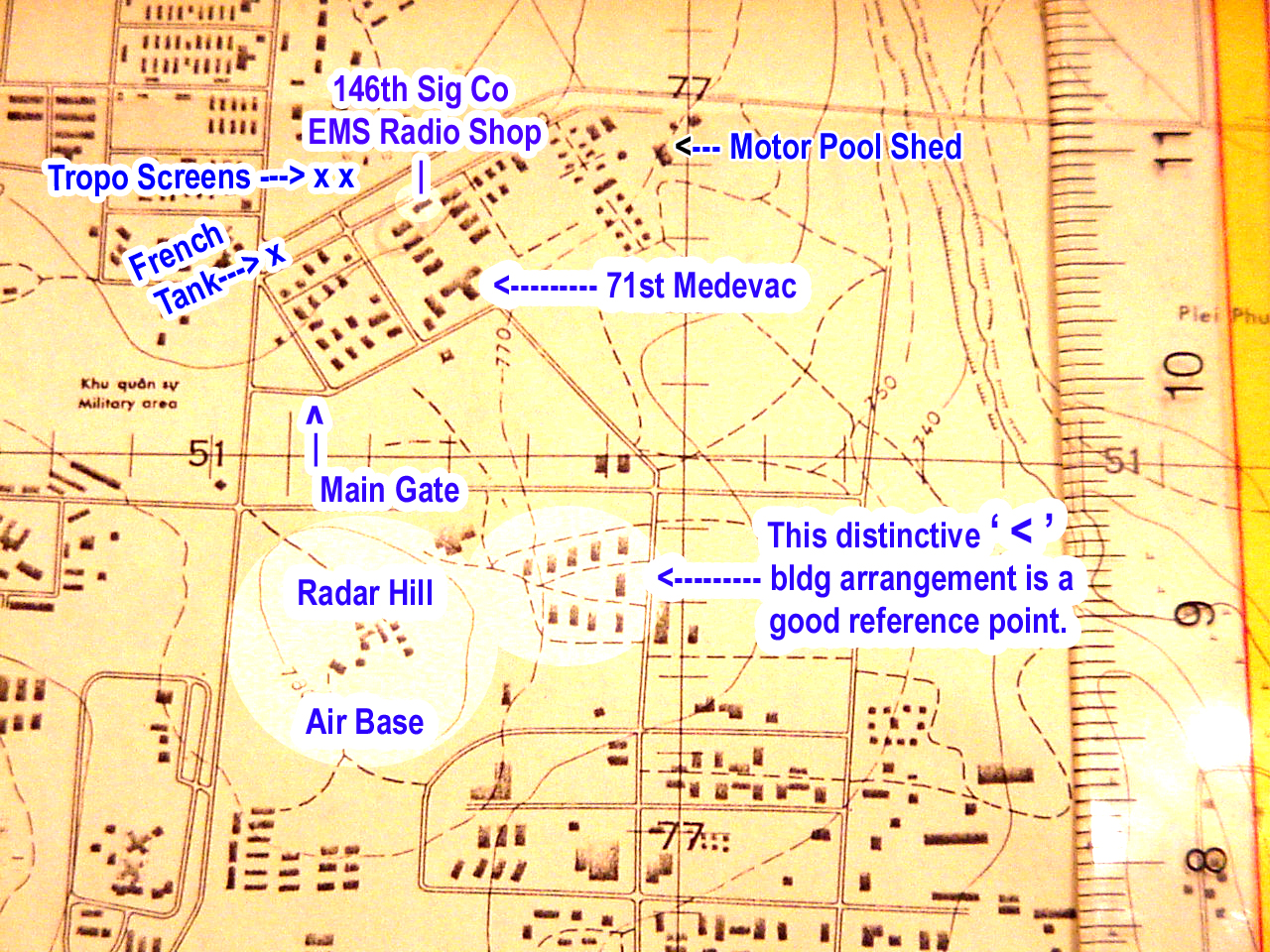
Confusing perhaps, but at different times I refer to our 146th EMS Shop, as 146th Signal Maintenance Shop, EMS, 146th Maint., 146th Sig Co EMS Radio Shop and perhaps other names. Some day I may fix that, but suffice to say they all refer to the same building where we fixed broken radio/telephone equipment. There weren't many repair shops for consumer electronics so some of us fixed that kind of stuff too. Parts were hard to find though. We cannibalized whatever we had available.
|
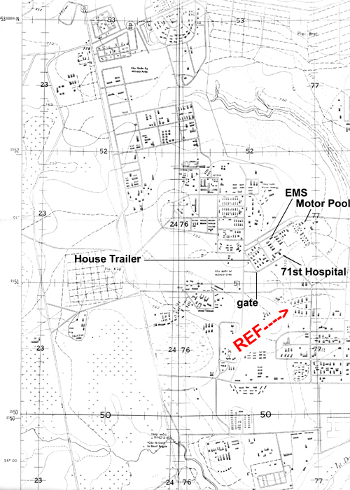
Admittedly there is quite a bit of redunancy in these pictures and maps of the 146th Sig. Co. / 71st Medevac compound. It was roughly a 250 yd x 500 yd rectangle framing a relatively small 26 acre neighborhood. But each map and picture provides it's own unique details that may be more or less relevant to the viewer. Also, they demonstrate how much information is available if you do the research. If you served in a different part of RVN or perhaps in another country, you have a good chance for your own discoveries. I got my topo maps from the Geography and Map Division of the US Library of Congress in 1989. I assume they are still available. Google can give you current aerial shots and the internet is a potential treasure trove.
The close-up picture to the right has a distinctive group of isolated buildings that form an easy-to-spot landmark. I've marked some of the other photos and maps for comparison.
|

|
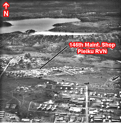
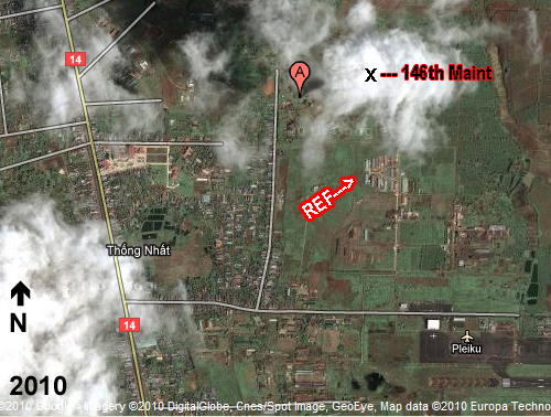
This picture of our compound was taken from the south and farther out. The landmark buildings pictured above are clearly visible in this picture, but the angle skews the picture making them less obvious. Additional construction adds clutter to further confound spotting them.
|
|
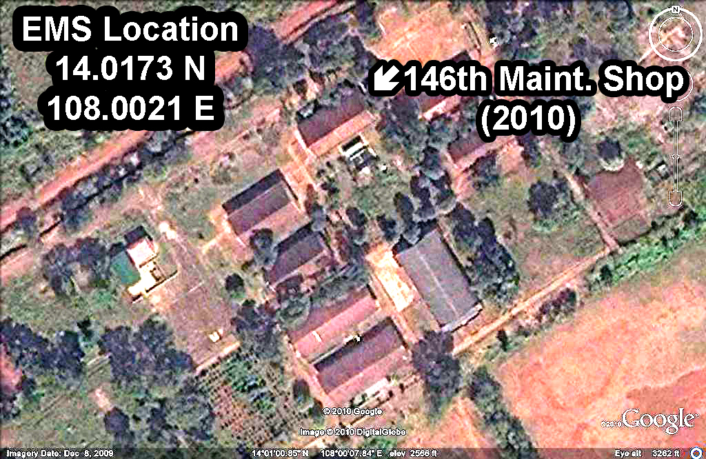
Comparing the pictures above, 2010, and right, 2013, it looks like they did some roof maintenance. Maybe they painted over the rust or maybe re-roofed them. Either way, it's probably cooler inside.
|
 My 1971 'home' becomes more and more unrecognizable with each passing year. It doesn't help that my memory is getting rustier too.
|

|
Picture at left shows the west end of the Pleiku Air Base runway in the bottom right corner.
|
|
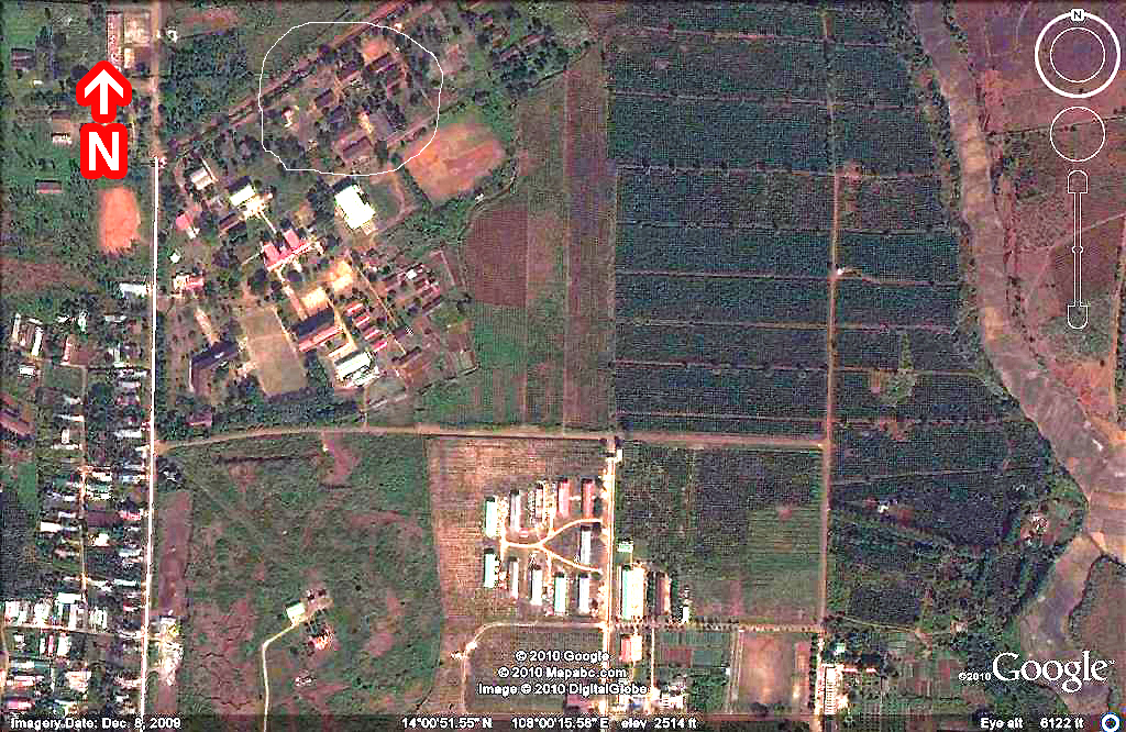
Left: our EMS in the shade. Above: EMS and barracks are circled.
|
|
RETURN TO TOP RETURN TO HOME PAGE
Revised 07/17/18
Contact Webmaster
© Copyright 2012-2018. All rights reserved.
|